Research & Article
Maps of Bangkok, 1856 to 1861: The Changing Face of the Capital in the post-Bowring Treaty Transition Period
By Simon Landy
Published on 9 May 2024
History
Location of original sources
Journal of the Siam Society Vol. 108 No. 1 (2020)
Download
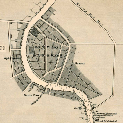
The first detailed survey of the Chaophraya River from the Gulf of Siam to Bangkok was a fortuitous by-product of a British mission led by Captain John Richards to survey the Gulf coast in the late 1850s. Richards’ 1856 map of Bangkok’s river was to provide the template for a map of greater cultural significance produced by the American missionary, Dan Beach Bradley, three years later, which provides insight into the scale and juxtaposition of the new Western residents and the existing business community. This article collates information from the UK National Archives to show how Richards’ map came about and King Mongkut’s attitude to the survey, and then looks at the physical details presented by Richards. The discussion moves on to the maps of Bangkok printed by Bradley in 1860-1861, their evolution and importance, starting with the genesis of the map of the four rivers of central Thailand compiled by the American missionaries, and finally focusing on how Bradley’s detailed mapping of the Bangkok riverfront illustrates the changes, continuity and relative spatial positioning of the leading foreign communities of Bangkok during the first years after the signing of the Bowring Treaty in 1855, when the city was experiencing its first wave of Western influence.